Camino Francés
Saint Jean Pied de Port → Santiago de Compostela
The one everybody means when they say “the Camino”. 769 km from Saint Jean Pied de Port to Santiago, with a bed never far away, which is why it forgives almost any mistake you make planning it.
New information comes in every day — from pilgrims on the road and people I know along the way — and it goes out the moment it does. The app carries all of it offline, and it's still being built: new features arrive routinely.
Pilgrims on the road and friends along the way send me changes every day, and they go out the same day. The Camino Frances and Camino de Invierno app carries all of it offline, and it's still being built — new features arrive routinely.
Get the appFrom the listings on this site, recalculated as they change. 26 albergues ask for a donation rather than a price: pay what the night was worth to you, not nothing.
If this is your first Camino, walk this one. Not because it is the prettiest, though parts of it are, and not because it is the easiest, though after the first two days it mostly is. Because it forgives you. Beds are close together the whole way, the waymarking is the best in Spain, and there is always someone a few hundred metres ahead who has done this before. Every mistake a first-timer makes, this route absorbs.
Who it isn't for: anyone who wants to be alone. In May, June, September and October you will walk in company whether you like it or not, and from Sarria onward the road is full. If solitude is the point, look at the Norte, the Plata or the Primitivo. If you want the Camino that the word usually means, this is it.
It starts in Saint Jean Pied de Port, on the French side of the Pyrenees, and the first day crosses them. That is the hardest walking on the whole route and it comes on day one, with your pack at its heaviest and your feet at their softest. There are two ways over: the Napoleon route, high and open and spectacular in clear weather, and the Valcarlos route along the valley road. The Napoleon route is closed from November to March, and closed by the weather at other times too. Take the valley when the pass is shut. People ignore this every year and the mountain does not care.
After Roncesvalles the road settles into Navarra: green, hilly, wooded, with Pamplona at the end of the third day. Then La Rioja, which is vineyards and red earth and, to my mind, the best eating on the route. Burgos marks the start of the Meseta, roughly three hundred kilometres of high, flat wheat country between Burgos and León. People either love it or take a bus past it. Walk it. It is the part you remember at two in the morning six months later.
León is the last big city. After it the land rises again through the Montes de León to the Cruz de Ferro, the highest point on the route, then drops steeply to Ponferrada and the Bierzo. O Cebreiro is the climb into Galicia, and from there to Santiago it is wet, wooded, green and busy, because everyone who started in Sarria for the last hundred kilometres has joined you.
Day one is a mountain day and should be treated as one. Beyond it the difficulty is not in any single climb but in the length: five weeks of walking, day after day, on feet that were not built for it. The Meseta is flat and looks easy and breaks more people than the Pyrenees do, through heat, monotony and the temptation to walk too far because the ground is level.
Three climbs matter after the first: the Alto del Perdón outside Pamplona, the long pull up to the Cruz de Ferro, and O Cebreiro. None of them is technical. All of them are long. The descents into Zubiri, into Molinaseca and into Triacastela are harder on the knees than the climbs were on the lungs.
The surface is mostly farm track and path, with more road walking than people expect between Burgos and León. Good shoes matter more than boots. Poles help on the descents.
This is the reason to walk the Francés. Beds are never far apart. Walk four kilometres more than you meant to and there is somewhere at the end of it. Stop early because your knee is complaining and there is somewhere there too. No other route gives you that much room to be wrong.
The bed comes in every form. Municipal and parish albergues, which are cheap, basic and often the best company. Private albergues, which cost a little more and usually have a washing machine and a smaller dormitory. Pensions, hostales and hotels in every town of any size, for the nights when you want a door that closes. Every town on this page lists all of them, with prices and beds, and the table on each town's page shows every place with beds within a day's walk. That table is how you plan this route: not by stages, but by deciding tonight where you would like to sleep tomorrow.
In July and August, and from Sarria onward in any month, the municipal albergues fill by early afternoon. Book the private ones a day ahead if that worries you, or simply walk a little further to the next village, which is usually emptier.
The prices at the top of this page are not estimates. They come from the listings on this site, every place to stay on the route with a price attached, and they are recalculated whenever the listings change. The figures shown are the middle half: a quarter of places cost less, a quarter cost more.
Municipal and parish albergues sit at the bottom of the dormitory range. Some of them, and a few private ones, are donativo: there is no price, and you leave what the night was worth to you. That is not a discount and it is certainly not free. It is a tradition older than the price list, kept alive by volunteers who cook for you and ask for nothing, and the places that run on it close when pilgrims treat it as nothing. Leave what you would have paid, or more if you can. Private albergues sit at the top of the dormitory range and usually give you a smaller room and a washing machine for the difference. A double room is the number to look at if you are walking as a pair: split two ways it is often not much more than two dormitory beds, and the door closes.
Food is the same everywhere on the Francés and cheap by any northern standard: a menú del día of three courses with wine at lunch, a pilgrim menu of the same shape in the evening, breakfast at a bar for the price of a coffee and a tostada. Budget a bed, one menú and a bar breakfast a day and you have the floor; add a private room every night and a second restaurant meal and you have the ceiling. Most people land somewhere between.
May, June, September and the first half of October are the months most people choose, and they are right. Spring is green and cool with long days; autumn is golden, quieter, and the harvest is in. Both are busy.
July and August are hot on the Meseta, genuinely hot, 35 °C (95 °F) and no shade, and the albergues are at their fullest. Start before dawn and stop by one if you must walk then. April and late October are fine with a bit of luck and a waterproof. From November to March the Napoleon route is closed, some albergues shut, and Galicia is wet, but the road is quiet and it is a different and rather beautiful walk for those who want it.
Saint Jean Pied de Port has a small railway station on the line from Bayonne. Fly to Biarritz, take the bus or train to Bayonne, then the train up the valley. From Spain, buses run from Pamplona over the pass, and Pamplona is easy from Madrid and Barcelona by train. Many people simply start in Pamplona, Logroño, Burgos or León instead; every one of them has a station and every one of them is a real start.
Santiago has an airport with direct flights across Europe and a railway station with fast trains to Madrid. Most people stay two nights. Some walk on to Finisterre.
The road does not have to stop in the cathedral square. The Camino to Finisterre and Muxía leaves Santiago westward for the coast: three or four days to the end of the known world, with the pressure off and the crowds gone. It is the most pleasant walking of the whole journey, precisely because it does not count.
Coming the other way, the Camino Aragonés joins the Francés at Puente la Reina from the Somport pass, and the Camino de Invierno branches off at Ponferrada for those who would rather go around the mountains than over them. Both are on this site.
Show or hide:
Saint Jean Pied de Port — Donibane Garazi in Basque — is where the majority of Camino Francés pilgrims begin. Several European routes converge here, funneling walkers from Paris, Vézelay, Le Puy, and beyond into a single starting point at the foot of the Pyrenees.
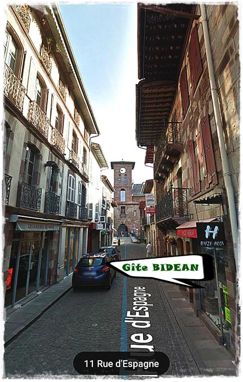
The town runs along the Nive river, its cobbled Rue de la Citadelle descending from the old fortress to the Porte d'Espagne, the medieval gate through which pilgrims have passed for centuries. It's a beautiful small town, made even more so by the anxious energy of all those about to set off.
The Pilgrim Office (39 Rue de la Citadelle) issues credenciales, stamps, and weather reports for the mountain crossing. It gets busy — arrive early or expect a queue. They'll also give you the latest on route conditions over the pass, which you should take seriously.
Accommodation fills up fast in summer. There are several albergues including the municipal Accueil des Pèlerins and the private Gîte de l'Esprit du Chemin, plus a range of hotels and gîtes d'étape along the Rue de la Citadelle and Rue d'Espagne. Book ahead if arriving on a weekend.
The town has everything you need: supermarkets, pharmacies, outdoor gear shops, ATMs, and plenty of restaurants. For your last French meal, the restaurants along the main street do hearty Basque fare — try the trout or the gâteau basque. Monday is market day, and coincidentally one of the quieter pilgrim days.
The mountain crossing to Roncesvalles is dangerous in bad weather. Snow, ice, fog, and high winds can all occur, even outside winter. Check the weather forecast at the Pilgrim Office before departing. These mountains have claimed lives — take the warnings seriously. If conditions are poor, take the Valcarlos route or wait a day.
Saint Jean Pied de Port — literally "Saint John at the Foot of the Pass" — has been a gathering point for pilgrims since the medieval period. It sits in Lower Navarre, historically part of the Kingdom of Navarre rather than France, and the Basque identity runs deep.
The Citadel above town was rebuilt by Vauban in the 17th century on older fortifications. The town's defensive walls, the Porte d'Espagne, and the Porte Saint-Jacques (a UNESCO World Heritage site since 1998) survive largely intact. For centuries this was the last provisioning stop before the dangerous mountain crossing into Spain, and the concentration of pilgrim infrastructure — hospitals, churches, hostels — reflects that critical function.
Two routes cross the Pyrenees to Roncesvalles: the Napoleon Route over the high pass (the traditional and more popular option), and the Valcarlos Route through the valley (lower, longer, and the bad-weather alternative). Both are approximately 25-27 km to Roncesvalles.
From the Porte d'Espagne, the Napoleon Route climbs steeply on road through Honto and past Orisson before gaining the ridgeline. The Valcarlos Route drops to Arnéguy and follows the valley road through Valcarlos before climbing steeply from Gañecoleta to the Puerto de Ibañeta.
The Napoleon Route is closed to walkers from November 1 to March 31 (and sometimes longer depending on conditions). During this period you must take the Valcarlos Route. Even outside the closure period, the Napoleon Route should only be attempted in clear weather.


Two routes cross the Pyrenees from Saint Jean Pied de Port to Roncesvalles. Your choice depends on the weather, the season, and your own fitness.
The Napoleon Route is the high road. It climbs steeply from town on asphalt through Honto and past Orisson, then follows the open ridgeline over the Collado de Bentartea and the Collado de Lepoeder before descending through beech forest to Roncesvalles. The views are extraordinary — on a clear day you can see deep into both France and Spain — but the exposure is total. There's no shelter above Orisson, and weather can change in minutes. This route is closed from November 1 to March 31.
The Valcarlos Route is the valley road. It drops to Arnéguy at the border, follows the N-135 through Valcarlos, then climbs steeply from Gañecoleta to the Puerto de Ibañeta before descending to Roncesvalles. It's longer, less scenic, and the road walking through the valley isn't the most inspiring, but it's the safe option in bad weather and the only option in winter.
Most pilgrims walk the Napoleon Route in good weather. It's the more dramatic and more historic crossing. But don't let pride push you up the mountain in dangerous conditions — the Valcarlos Route gets you to Roncesvalles just the same.
primary route
The Napoleon Route - 24.3 km
The Napoleon Route is the longer of the two and covers small mountain roads and trails. It was popularized as a way to bypass the banditry that was all too common in the valley below. You will soon see that up in the mountains, there are few places to hide.
During times of poor weather, this route will be closed. When the skies are clear you can see for miles, otherwise you are not likely to see past the horses and sheep that pasture here.
alternate route
The Valcarlos Route - 23.5 km
The Valcarlos Route follows close to the road and is the advised route during poor weather. It passes through two towns (with services) located directly on the road between here and Roncesvalles, and two villages that are not on the road and which have no services.
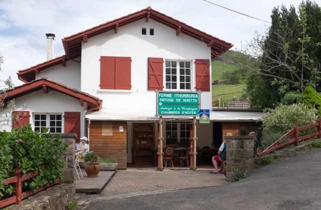
Honto is the first hamlet on the Napoleon Route, about 5 km from Saint Jean Pied de Port and 400 m higher. A small cluster of farmhouses with a bar and the Ferme Ithurburia gîte d'étape, which also serves meals. This is the last chance to eat or drink before Orisson (another 3 km up the road).
If you're feeling the climb already, this is a good reality check — you're less than a quarter of the way to Roncesvalles and the steepest sections are still ahead.
Beyond Honto the road continues to climb steadily on asphalt. After about 1 km the camino leaves the road for the first time, winding uphill through a series of switchbacks. The Kayola albergue, operated by the Orisson team, sits just off the route with beds and a small terrace. From here it's roughly 2 km more to Orisson.
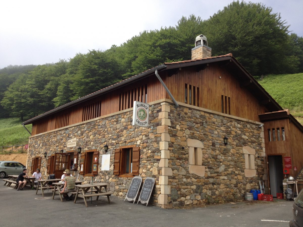
Orisson is a popular stopping point for pilgrims splitting the mountain crossing into two days. The Refuge Orisson is a purpose-built gîte with bunks, a restaurant, and a terrace with sweeping views back toward Saint Jean and the French Basque Country. Dinner is communal and lively — it's where many pilgrim friendships begin.
Booking is essential, especially from April to October. The refuge fills up weeks in advance in peak season. If you can't get a bed here, your options are to push on to Roncesvalles (another 19 km with 800 m more of climbing) or to go back down to Honto or Saint Jean.
A small shop sells basic supplies and cold drinks. There's no other commercial service between here and Roncesvalles.
If you arrive here late in the day, stop and ask about conditions ahead. Don't push on into deteriorating weather. Make sure someone at the refuge knows your plan if you continue — in bad conditions, people do get lost on the mountain above. Mobile phone reception is unreliable beyond this point.
Borda is a small cluster of buildings on the Napoleon Route between Orisson and the Pic d'Orisson. No services. The climb continues steadily from here as you leave the tree line behind and enter open mountain pasture.
A statue of the Virgin stands at the Pic d'Orisson (1,060 m), marking the point where the route leaves the last of the trees behind and enters fully exposed terrain. From here to the descent into Roncesvalles there's no shelter of any kind. On a clear day the views in every direction are immense — the Basque hills rolling north into France, the high Pyrenees to the east.
The Collado de Bentartea (1,340 m) is the high point of the ridgeline walk, sometimes called Napoleon's Pass. A food truck often parks here selling drinks, snacks, and bocadillos — welcome relief after the long exposed climb from Orisson. This is also the last chance for a stamp on the French side.
From here the route follows the ridge southward with Spain opening up to your left and France falling away to your right. On a clear day it's one of the finest stretches of walking on any Camino. In fog, it's disorienting and potentially dangerous — follow the markers carefully.
The Collado de Lepoeder (1,430 m) is the highest point on the Napoleon Route and the border ridge between France and Spain. From here the route begins its long descent through beech forest toward Roncesvalles, dropping nearly 600 m over the final 5 km. The change is dramatic — from exposed ridge to dense woodland in the space of a few hundred meters. The path is steep and can be muddy and slippery, especially after rain. Take your time on the descent; tired legs and wet roots are a bad combination.
Arnéguy sits right on the French-Spanish border, straddling the Nive river. It's the first settlement on the Valcarlos Route after leaving Saint Jean Pied de Port, about 8 km down the valley. A couple of bars, a few shops, and some accommodation options. The border crossing itself is unmarked and unremarkable — you simply walk across the bridge and you're in Spain.
Cross the main road (D933/N-135) and the bridge into Spain. The route follows a country road lower in the valley, bringing you into Valcarlos from below. The walking is flat and easy along the river.
Valcarlos (Luzaide in Basque) is the main town on the valley route, sitting in a deep green gorge along the Nive de Arnéguy. It's a quiet, slightly faded border town with the essentials: a couple of bars, a small shop, a pharmacy, and a few accommodation options including the Albergue Municipal and several casas rurales.
The modern church is often locked. Most services are along the main road — if you've entered from the lower valley path, you may need to walk a short distance back toward Arnéguy to reach them.
This is where Charlemagne's rearguard was ambushed by Basque forces in 778, the historical event behind the Song of Roland. The narrow valley makes the tactical logic of the ambush immediately obvious.
Leave town along the main road, eventually branching left onto a smaller road. Gañecoleta is less than 1 km from this junction. From there the serious climbing begins.
Gañecoleta is a tiny settlement on the Valcarlos Route where the serious climbing begins. A few scattered farmhouses, no services. From here the route climbs steeply — and relentlessly — toward the Puerto de Ibañeta, gaining over 600 m in roughly 8 km. The final few kilometers are particularly steep.
If you started in Valcarlos, this is where you begin to understand why the Napoleon Route is considered the harder option for its views rather than its difficulty — the Valcarlos Route has its own brutal climb.
The Puerto de Ibañeta (1,057 m) is where the two routes from Saint Jean Pied de Port converge — the Napoleon Route descending from the Collado de Lepoeder through beech forest, and the Valcarlos Route climbing steeply from Gañecoleta.
The modern Ermita de San Salvador marks the site of an older monastery that once received pilgrims at this pass. A stone monument to Roland stands nearby, commemorating the battle of 778. The views south toward the valley of Roncesvalles are a welcome sight after either crossing.
This pass has been an important crossing point since Roman times and was one of the principal routes into the Iberian peninsula. The chapel is usually open and makes for a quiet moment before the final descent.
Both routes rejoin in Roncesvalles
Roncesvalles (Orreaga in Basque) is where the Camino Francés truly begins for many pilgrims. Those who walked from Saint Jean arrive exhausted and triumphant; those starting here begin fresh-legged and wide-eyed. You can tell them apart by the length of their stride.
The village is tiny — essentially the Collegiate church complex, the albergue, the Posada hotel, and a handful of other buildings along a single road. Everything revolves around the Colegiata de Santa María, a 13th-century Gothic church where the pilgrim mass and blessing take place each evening. Don't miss it.
The albergue is one of the largest on the Francés with nearly 200 beds in a renovated medieval hospital. Dinner tickets are sold at reception; the communal dining room is a chaotic, multilingual affair and a great introduction to Camino social life. The Posada restaurant is the other dining option — more refined, with a solid menu del día.
It doesn't take long to see everything here, and almost every building has historical or artistic value. The Silo de Carlomagno (the oldest structure), the chapter house with its Romanesque capitals, and the 14th-century cloister are all worth a wander.
The Battle of Roncesvalles (778) is the founding legend. Charlemagne's rearguard, led by the paladin Roland, was ambushed and destroyed by Basque forces as it retreated through these mountains. The event was transformed into the epic Song of Roland, one of the oldest surviving works of French literature, though the poem replaced the Basques with Saracens for dramatic effect.
The Collegiate of Roncesvalles was founded in 1132 as a monastery and pilgrim hospital, and it has served pilgrims continuously since. The Gothic church of Santa María Real houses the silver-clad Romanesque Virgin of Roncesvalles. The 13th-century chapter house, known as the Silo de Carlomagno, is where tradition places the burial of the battle's fallen.
The camino starts on a path to the west of the main road, heading into beech forest before returning to the road as you approach Burguete. It's a gentle, flat walk of about 3 km — a merciful start after the mountain.
What the ground between two towns is actually like: everything you pass through, the climbing, and where you could stop along the way. Not a plan — a description.
Route index
810 km from Saint Jean Pied de Port to Santiago de Compostela. Most pilgrims walk it in 29 to 37 days. Every town below has its own page.


Esta entidad ha sido beneficiaria de una ayuda del Programa de incentivos a la movilidad eficiente y sostenible (MOVES III), gestionado por la Xunta de Galicia a través del Instituto Enerxético de Galicia (INEGA) en el marco del Real Decreto 266/2021, y cofinanciada por la Unión Europea — NextGenerationEU, dentro del Plan de Recuperación, Transformación y Resiliencia.